Fuerte de Coquimbo
⭐ 4.5(5,093) · 5,093 reviews

Fuerte de Coquimbo Fuerte Lambert · Coquimbo, Región de Coquimbo, Chile

A 19th-century hilltop fortress with 360° views across Coquimbo Bay, its port history and the Pacific coastline.

🕒 Open daily, 10:00–20:00

Usually free entry Family-friendly Suggested visit: 1 hour

Opening hours & key facts

The essentials before you climb: opening hours, admission, how long to allow and the exact location.

Opening hours
Daily, 10:00–20:00
Admission
Usually free to enter
Time needed
40–70 minutes
Address
Camino Al Fuerte 20, Coquimbo, Región de Coquimbo, Chile
Coordinates
3M87+8H Coquimbo, Chile -29.9341853, -71.3360829
How to get there

Plus Code and coordinates you can paste into any map app.

Discover Fuerte de Coquimbo

Welcome to Fuerte de Coquimbo, widely recognized as the central Fuerte Lambert. Located in Coquimbo, Región de Coquimbo, Chile, this hilltop fortress serves as a primary hub for travellers exploring the maritime heritage of northern Chile.

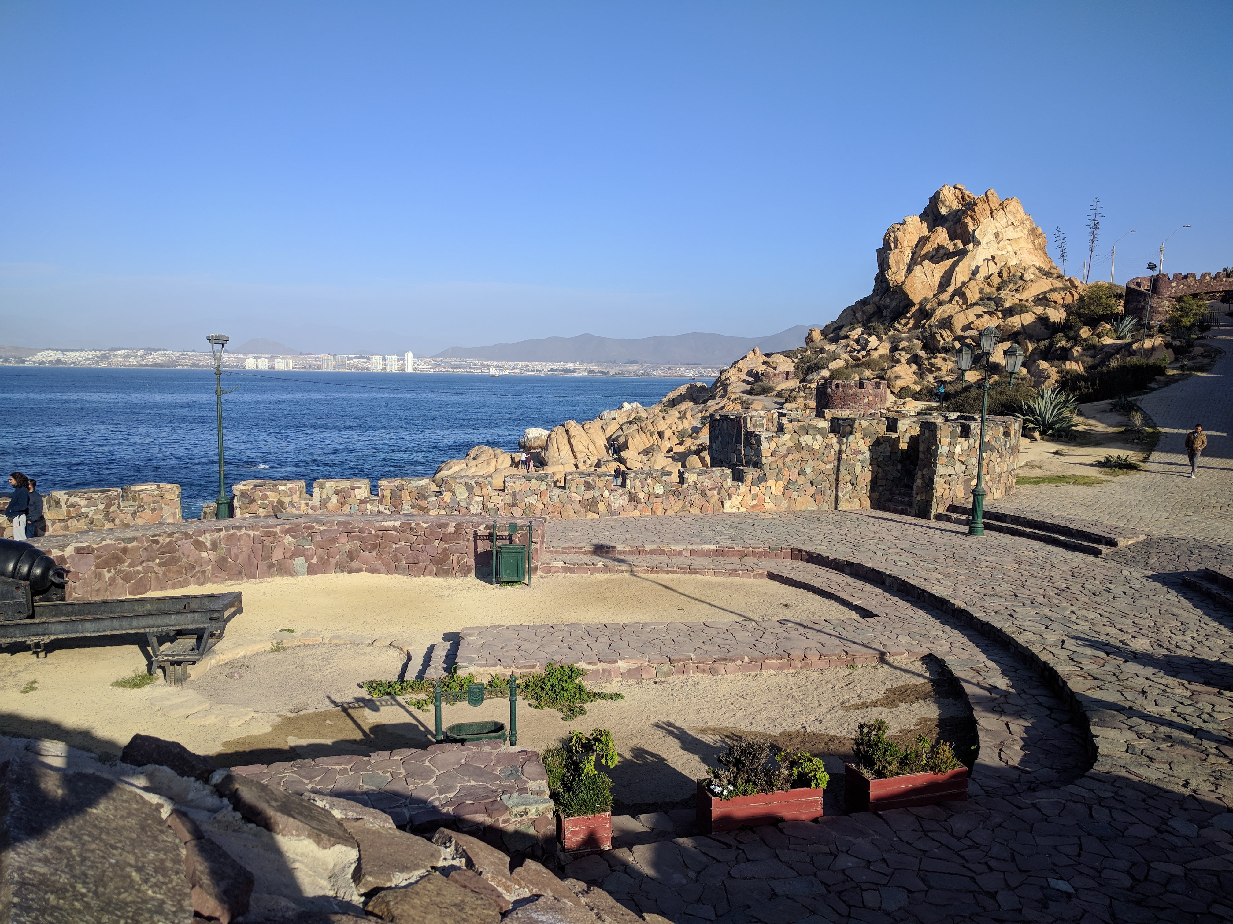
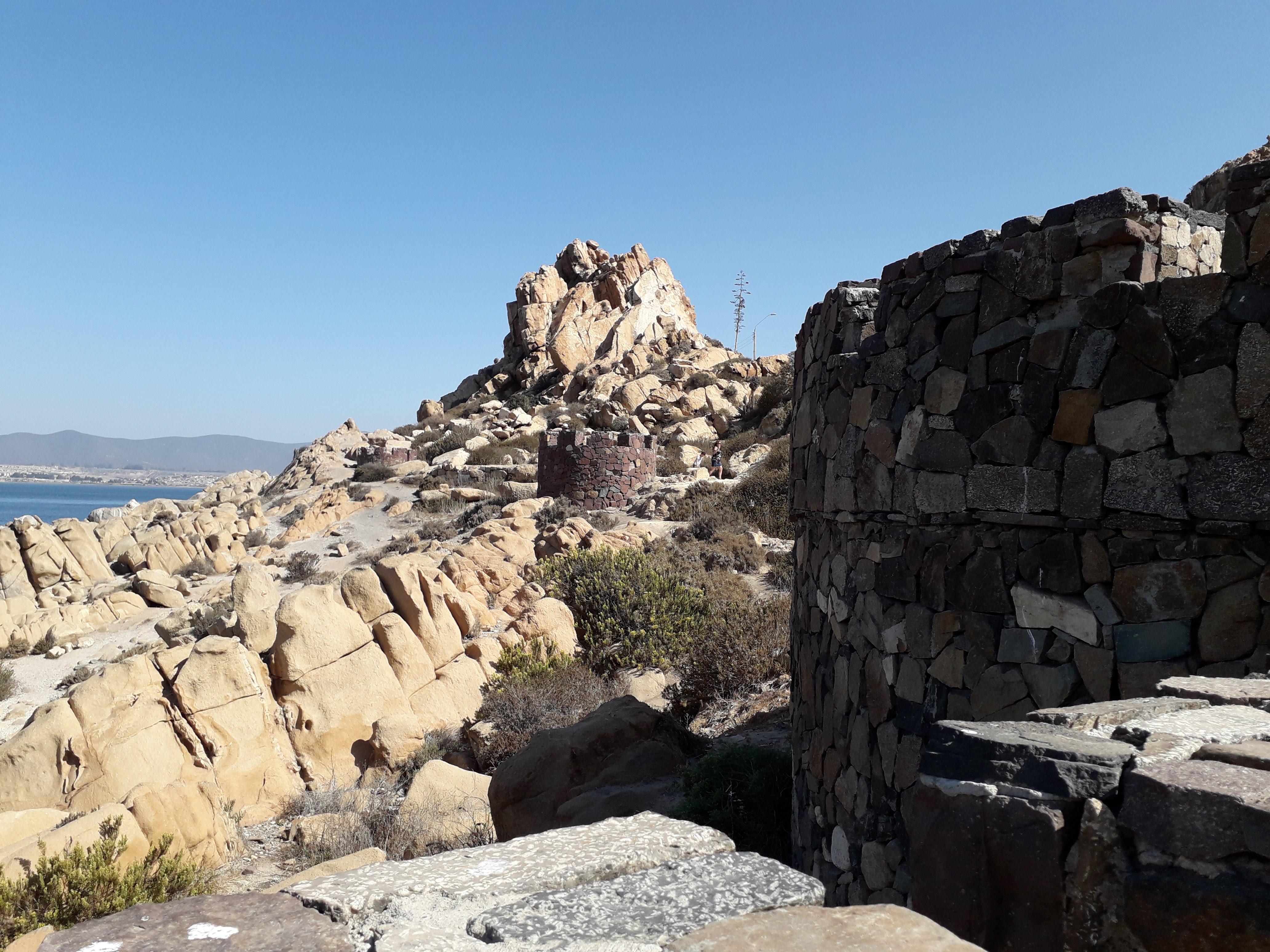
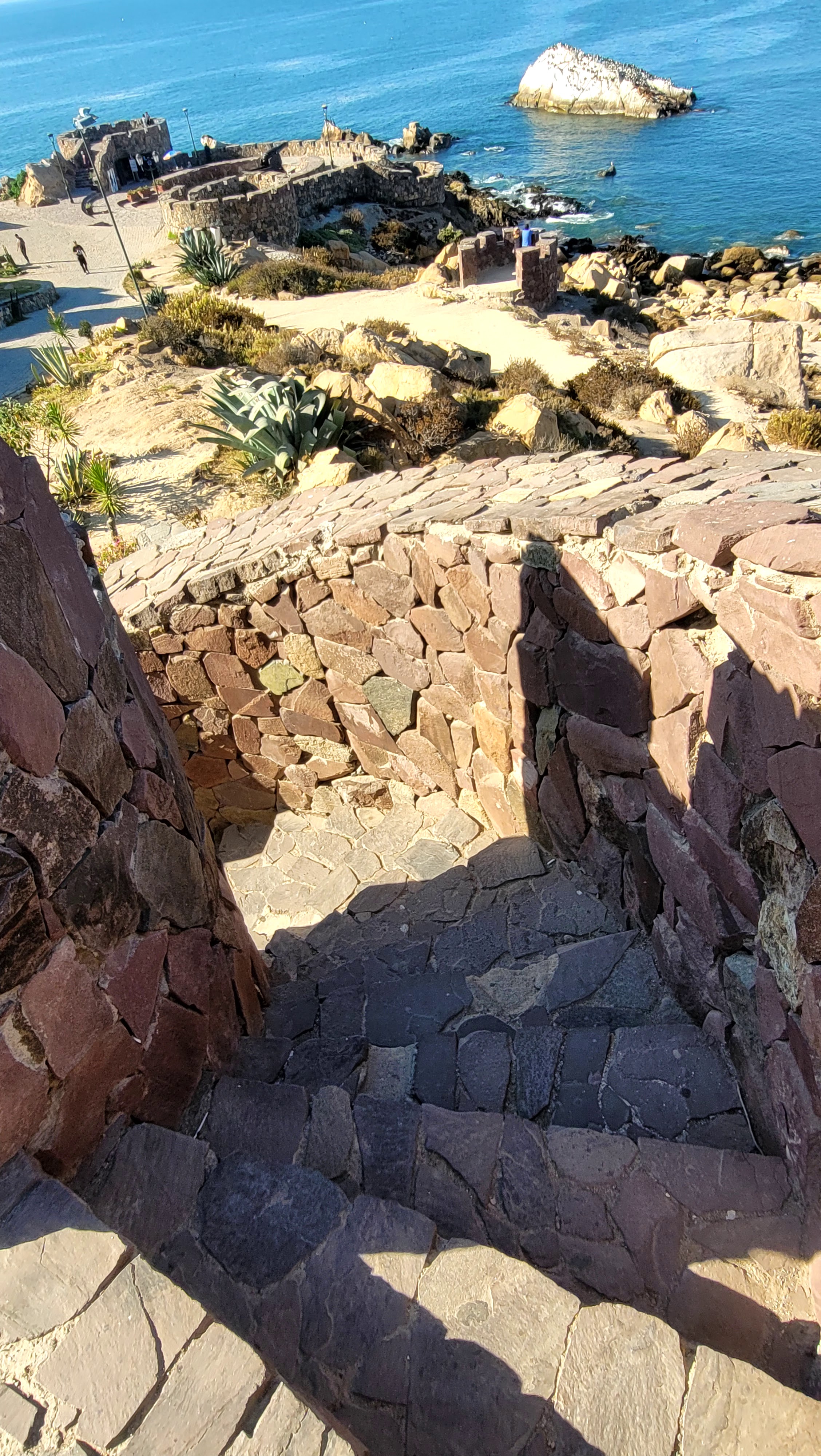
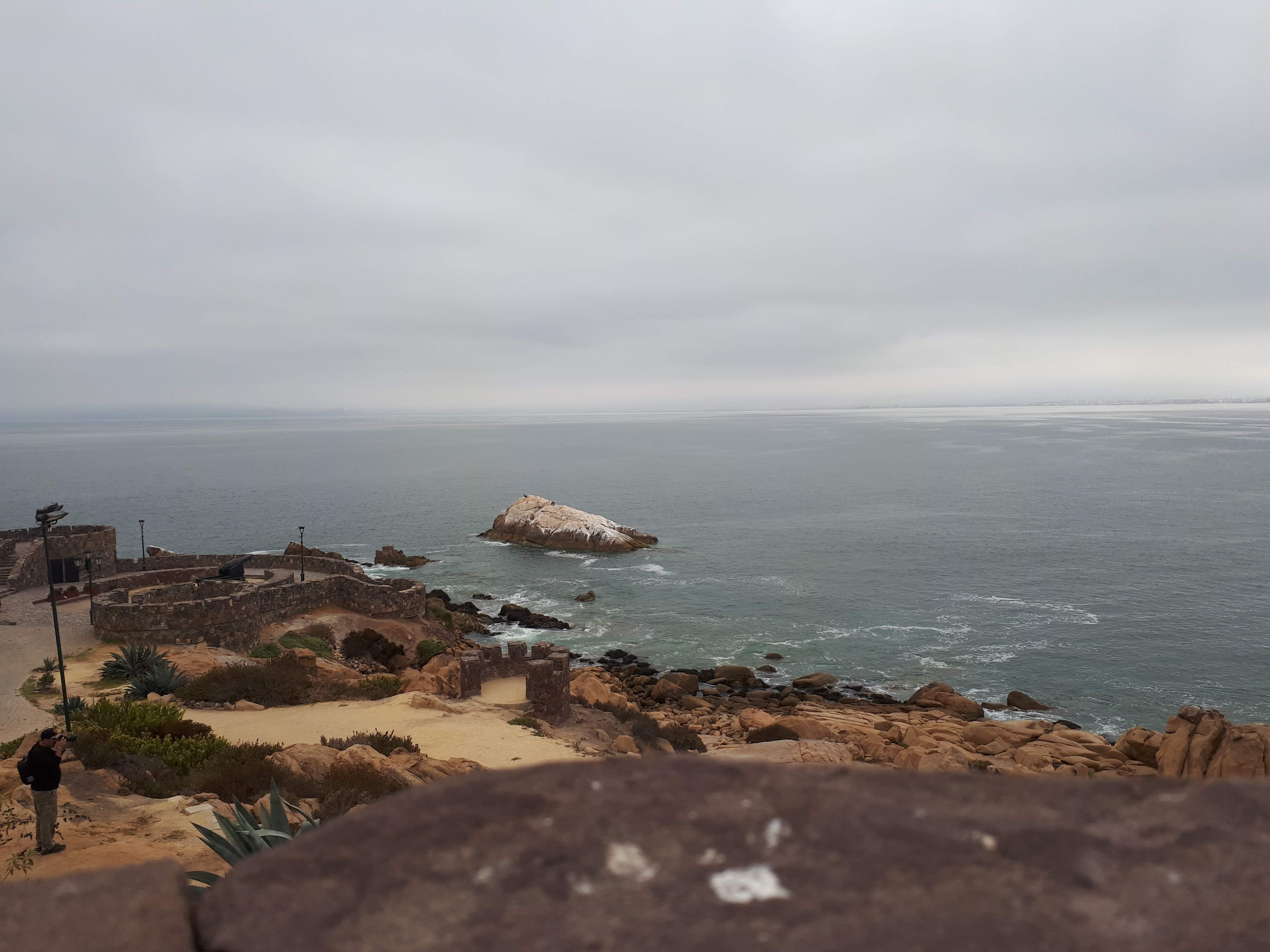
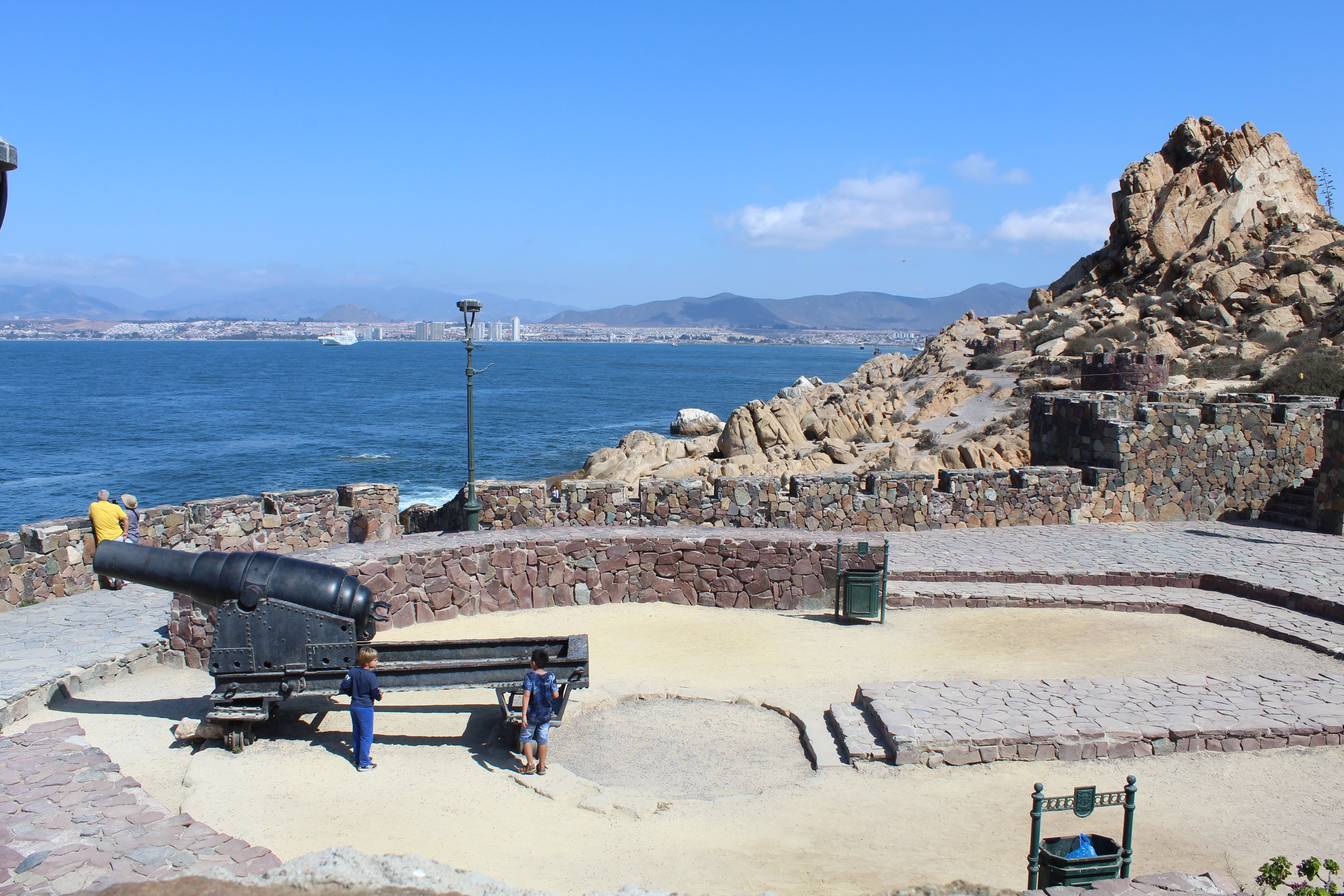
Fuerte de Coquimbo, also known as Fuerte Lambert, is a 19th-century military fortification built by the Chilean Army on the hill that overlooks Coquimbo Bay. It was part of a coastal defence system raised to protect the port, then one of the busiest on the country's northern coast. Today it is a National Monument and a natural viewpoint: from its ramparts and tunnels you can take in the peninsula, the harbour and the Cruz del Tercer Milenio. It is one of the most photographed spots in Coquimbo and a must-stop for anyone exploring the Coquimbo Region.

When visiting Fuerte de Coquimbo, visitors can easily explore surrounding historical landmarks and points of interest, including the Cruz del Tercer Milenio and the port and peninsula of Coquimbo.

About the Fort

Fuerte de Coquimbo is a National Monument managed within the framework of the defence of Chile's military heritage. The fortification and its ramparts are part of the bay's defence system built by the Chilean Army in the 19th century to safeguard the port. Today it is maintained as a publicly accessible historic site, where cannons, tunnels and the panoramic esplanade are preserved. Together with the Municipality of Coquimbo and regional agencies, the site is part of the identity and heritage offering of the Coquimbo Region.

Highlights

  • 19th-century fortress and National Monument of Chile
  • 360° views over the bay, harbour and Cruz del Tercer Milenio
  • Preserved cannons, tunnels and walls from the coastal defence system
  • Viewpoint and military-history site in the Coquimbo Region

Weather at the Fort

Real-time conditions and a forecast for Coquimbo, so you can plan the climb and the viewpoint.

11°C
Clear sky
Rain chance
10%
Wind
0 km/h Force 3
Feels like
11°C
UV index
6.8
Humidity
92%
Precipitation
0 mm
Sun
07:48 / 19:35

Updated: 02:37 AM

What to wear

  • Day and night differ by more than 8 °C: bring a layer you can take off.
  • The sun is strong: hat, sunglasses and sunscreen.

How to plan the day

  • Low tide uncovers the rock pools: the steadiest window to walk down, with one eye on the swell.
  • Clear weather: ideal for the footpaths and for watching the sunset from the fort.
  • On a hilltop the wind strengthens and it feels several degrees colder than downtown.

What to bring

  • Sunscreen
  • Sunglasses
  • Hat or cap
  • Plenty of water
  • A spare layer

Sea state

Swell
0.98 m
Period
11 s
Water temperature
15.7 °C
  • Calm sea: good conditions for reading the coastline from the viewpoint.
  • This is a rocky, unpatrolled coast: it is not meant for swimming.

Tides

Range today: 1.42 m

Water level now

-0.39 m

↓ Falling

Next low tide

1h 23min

04:00 · -0.58 m

High tide Low tide Water level now

Best window on the rocks

15:30–18:30

Around low tide, give or take an hour and a half, the rocky shore is at its most open.

Next few days

  • Today

    • ↓ Low tide 04:00 · -0.58 m
    • ↑ High tide 10:00 · 0.77 m
    • ↓ Low tide 17:00 · -0.65 m
    • ↑ High tide 23:00 · 0.57 m
  • Sat

    • ↓ Low tide 05:00 · -0.59 m
    • ↑ High tide 11:00 · 0.73 m
    • ↓ Low tide 17:00 · -0.58 m
    • ↑ High tide 23:00 · 0.64 m
  • Sun

    • ↓ Low tide 06:00 · -0.53 m
    • ↑ High tide 12:00 · 0.66 m
    • ↓ Low tide 18:00 · -0.49 m

Next few days

  • Today
    Overcast
    18° /
    💧 10%
    Force 3
  • Sat
    Overcast
    18° /
    💧 0%
    Force 3
  • Sun
    Overcast
    17° /
    💧 0%
    Force 3
  • Mon
    Overcast
    18° / 10°
    💧 0%
    Force 2
  • Tue
    Overcast
    17° / 11°
    💧 0%
    Force 3
  • Wed
    Overcast
    17° / 12°
    💧 6%
    Force 3
  • Thu
    Overcast
    17° / 11°
    💧 0%
    Force 2

Before you head up

  • The hill is exposed: wind and sun feel stronger here than downtown. Bring a light layer even in summer.
  • From December to March the UV index is very high; a hat, sunglasses and sunscreen are worth carrying.
  • Coastal fog (camanchaca) usually clears around midday, but it can wipe out the view entirely.
  • In strong wind the walk up and the time spent at the viewpoint become much more demanding.

How to Reach Fuerte de Coquimbo

Focus on the four transport choices that matter most, from regional arrival to the final climb up to the fort.

Start with where you are coming from

For most visitors, the real decision is how to get into Coquimbo and how to manage the last stretch uphill. From Santiago, Valparaiso or Vina del Mar, the long-distance bus is usually the most straightforward entry. Once in town, choose a taxi, colectivo, self-drive approach or the climb on foot depending on time, energy and who is travelling with you.

Know this before you set out

  • The fort sits on a hill, so the final approach is usually by vehicle or on foot up the slope.
  • Downtown Coquimbo, the port and the bus terminal are all relatively close.
  • In summer and on weekends it gets busier; mornings are usually calmer.
🚌

Regional Arrival

Long-distance Bus

From Santiago, Valparaiso or Vina del Mar, the coach remains the clearest and most practical way to enter Coquimbo.

  • -From Santiago, the journey usually takes about 5 to 6 hours via the Ruta 5 Norte.
  • -The Coquimbo bus terminal sits relatively close to the hill where the fort stands.
  • -If you are not driving, this is the best-balanced option for cost, frequency and convenience.
🚕

Final Stretch

Taxi Or Colectivo

From downtown, the port or the bus station, a taxi or colectivo is the least tiring way to reach the entrance.

  • -Choose a taxi first if you are travelling with children, older companions or camera gear.
  • -Colectivos are usually cheaper and still save you from most of the climb.
  • -From La Serena, many visitors first reach central Coquimbo and transfer here.
🚗

Driving Visit

Self-drive Route

Driving works well if you are linking the fort with Coquimbo, La Serena and other coastal stops in one trip.

  • -Approach via the Ruta 5 Norte and continue towards Camino Al Fuerte.
  • -Parking is usually available on the grounds or close by.
  • -On the uphill approach, avoid stopping on narrow bends or tight roadside stretches.
🚶

Slow-Paced Approach

Walking Or Cycling

If you want the climb itself to be part of the experience, walking or cycling reveals the relationship between the bay, the slope and the port.

  • -The slope feels noticeably harder in summer and around midday, so start early.
  • -Cycling shortens the approach, but it still demands steady effort.
  • -From the port or peninsula, the ascent offers some of the most photogenic bay views.

Useful tips for the final approach

  • The hill climb is exposed to wind and sun; bring water and a hat, especially in summer.
  • If driving, use the on-site parking so you don't leave the car on a narrow stretch.
  • Line up your arrival with opening hours (10:00–20:00) so you don't find the site closed.

Visitor Services & Practical Information

What is useful to know before you go up: services, urban amenities, access and neutral recommendations.

This is an independent, non-profit website. We only list categories of services and urban amenities to help you orient yourself; we do not recommend, promote or have any commercial relationship with any specific business.

  • Restrooms (WC)

    Public restrooms are not always available inside the site. You will usually find facilities in central Coquimbo, around the port area, and in cafés or restaurants where you are a customer.

  • Parking

    There is room to park beside the access road and on nearby streets; it fills up in summer and on long weekends. Paid car parks operate downtown and near the port.

  • Where to eat

    Options cluster in central Coquimbo and around the port and Guayacán: cafés, bakeries, soda fountains, pizzerias and seafood restaurants. You can also plan a picnic if you bring your own food.

  • Accommodation

    Coquimbo, La Serena and the Elqui valley offer hotels, hostels, cabins and campsites in a range of categories and prices. Booking ahead is advisable in high season (January–February).

  • Supermarkets & shops

    Supermarkets, convenience stores, pharmacies and local markets are found downtown and in the residential districts. For a wider choice, La Serena has more variety.

  • Fuel & EV charging

    Service stations sit along Ruta 5 and on the roads into town. Electric-vehicle charging points are concentrated along the Coquimbo–La Serena corridor, so plan your charge in advance.

  • Accessibility

    The ground is uneven and mixes ramps with steps. The paved access and the esplanade are manageable with assistance; some upper areas and the viewpoint edge involve level changes.

  • Water, shade & shelter

    Do not count on drinking water or continuous shade along the route. Carry water, sun protection and a warm layer in case the wind shifts.

  • Mobile signal & ATMs

    Mobile coverage is good across the city and there are ATMs downtown and beside the main shops. Do not expect reliable mobile data at every point on the hill.

  • Visiting with family

    The walk suits families with supervision: some edges have no railing and there are patches of loose rock. The viewpoints give you room to rest and talk about the landscape.

Emergency numbers in Chile

Valid nationwide from any phone, even without credit.

  • Police (Carabineros) 133
  • Fire brigade 132
  • Ambulance (SAMU) 131
  • Maritime rescue (Navy) 137
  • Investigative police (PDI) 134

Good practice at a heritage site

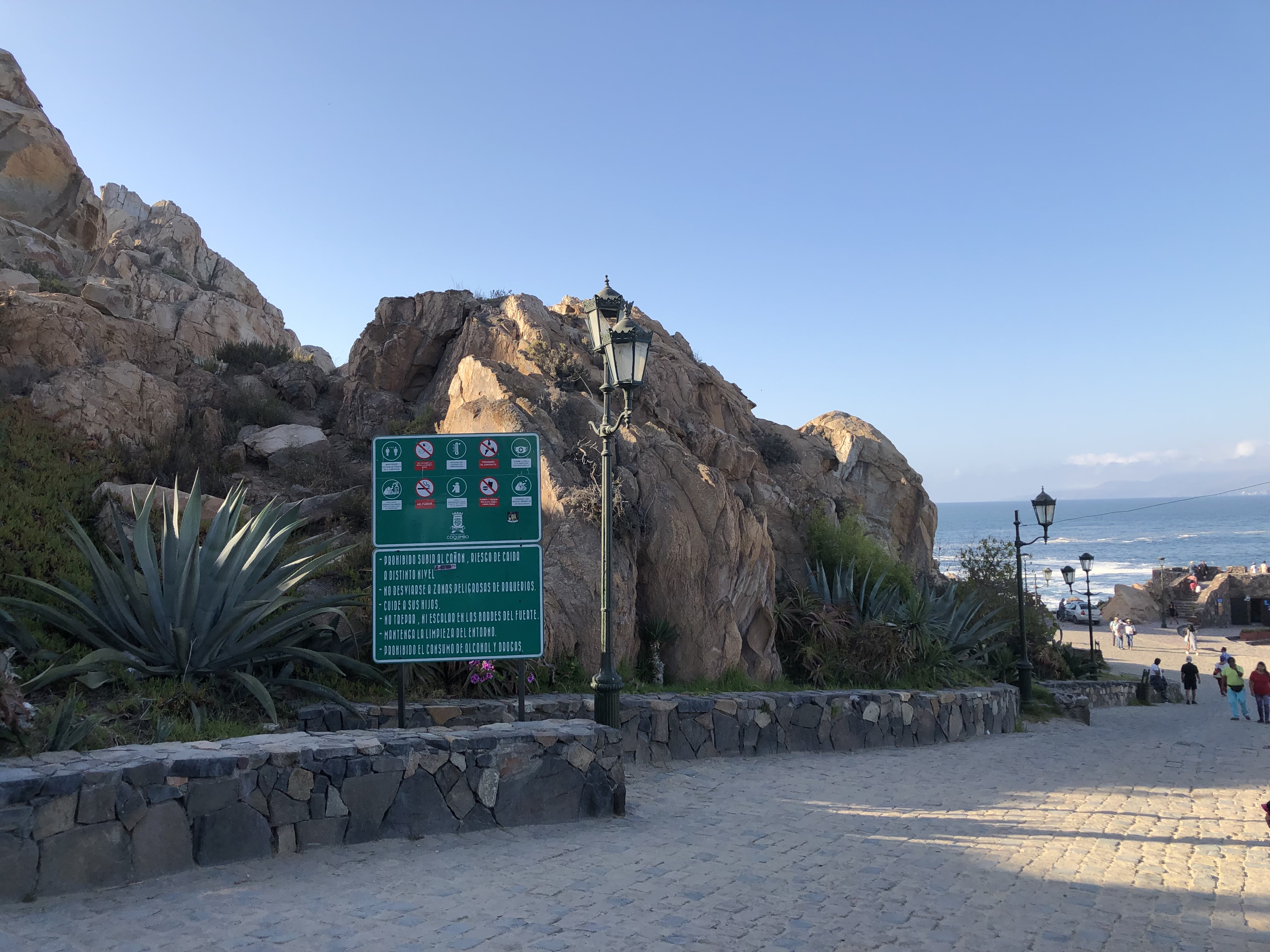
  • Stay on the marked paths when walking the walls and structures: stone erodes quickly under foot traffic.
  • The cannon and the surviving fortifications are heritage: do not climb them or leave marks.
  • Take your rubbish back with you; coastal wind scatters it very quickly.
  • Check local rules before flying drones or setting up recording equipment.
  • Respect the wildlife of the islet and the shoreline, especially during nesting season.

History, Meaning & Legend of the Fort

1

Origins (19th century)

Coquimbo Bay was strategically important from colonial times, when galleons and later merchant ships called at its waters. After independence, the Chilean state reinforced the defence of its coastline and, throughout the 19th century, raised fortifications to protect the port of Coquimbo from pirates, privateers and naval threats. Fuerte Lambert — a name that honours a military engineer of the era — was built on the hill that closes the bay, using its height to watch over maritime access. Its walls, ramparts and tunnels are part of that coastal defence system that accompanied the port boom of northern Chile.

2

Why Here?

The fort was placed atop the hill for a clear military reason: the point dominates the bay's entrance and allowed control of maritime traffic while protecting the port. Symbolically, it is also a natural lookout over Coquimbo, La Serena and the Pacific. Its elevated position made it an indispensable watchtower and, today, one of the best panoramic balconies of the region.

3

Local Stories

Those who grew up by the bay say that, on foggy nights, the wind through the fort's tunnels sounds like the echo of the troops who once guarded it. Another popular story says the Cruz del Tercer Milenio, visible from the ramparts, was raised to bless the sailors who depart from and return to Coquimbo Bay. Legend or devotion, the fort remains a place where military memory and local faith meet.

4

A Symbol of Coquimbo

Today Fuerte de Coquimbo is a National Monument and a landmark of local identity. From its walls you can take in the peninsula, the harbour and the Cruz del Tercer Milenio, and its esplanade is one of the city's most beloved viewpoints. Alongside La Serena and the Elqui Valley, it is part of the heritage and tourism triangle of the Coquimbo Region, and an essential stop for understanding the maritime history of northern Chile.

History, Stories & How to Read the Fort

A nineteenth-century defensive fortification on cerro Castillo del Carmen: a timeline, the elements that survive, and the landscape that explains its position.

Timeline of the bay and the fort

  1. 1865

    The first guns

    During the war with Spain, two small cannon were placed on cerro Castillo del Carmen to defend the bay of Coquimbo. Years later the intendant José Santiago Aldunate ordered them removed.

  2. 1870s

    A port that had to be protected

    The bays of Coquimbo and Guayacán concentrated the north’s trade and mining exports. Local accounts mention artillery being brought south-to-north from the fortress of Valdivia to strengthen the port’s defences.

  3. 1879

    The birth of Fort Lambert

    In the middle of the War of the Pacific, the entrepreneur Carlos J. Lambert drove the construction of a new fort in the same sector, to protect the port of Coquimbo from possible attacks by Peruvian ships.

  4. 10 July 1879

    The Armstrong gun

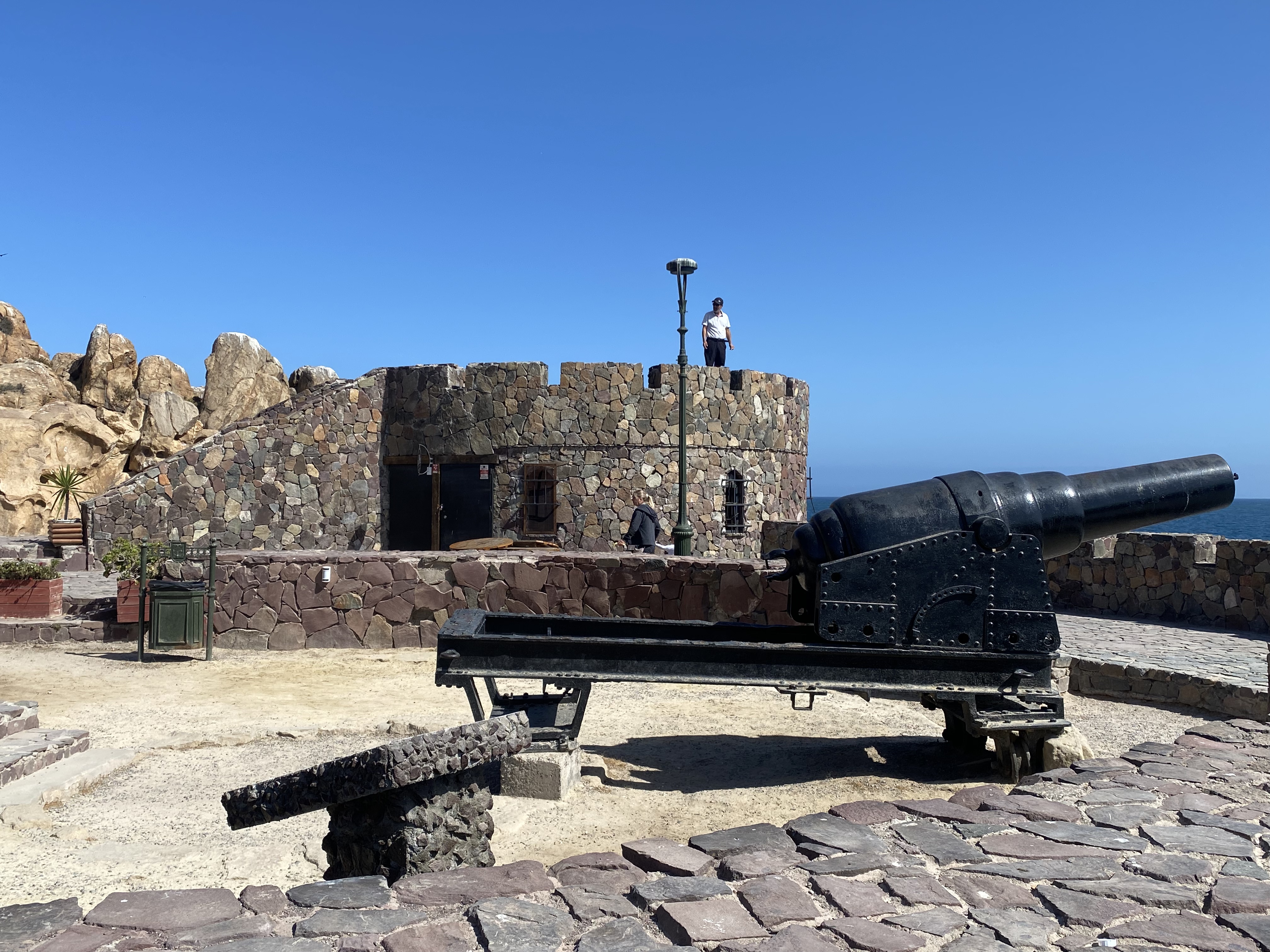
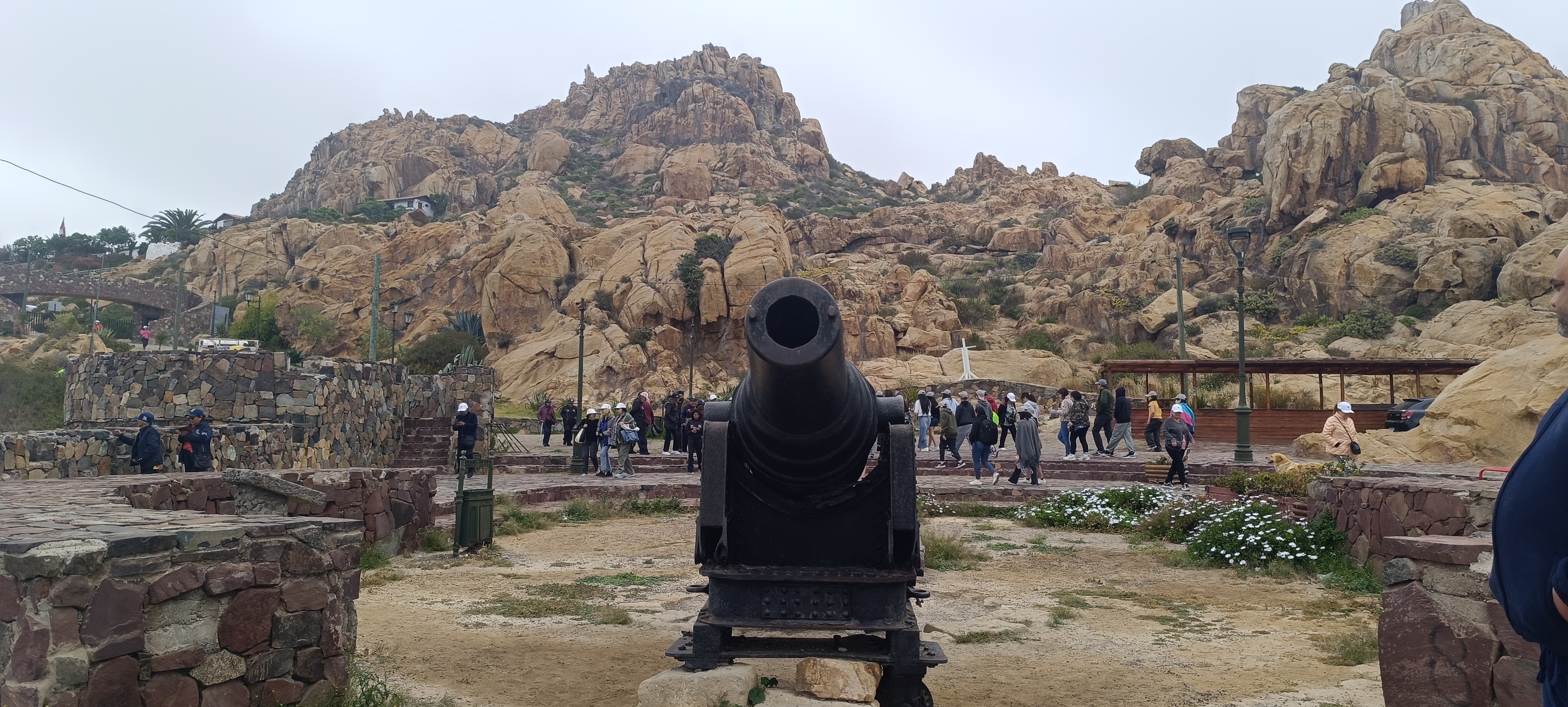
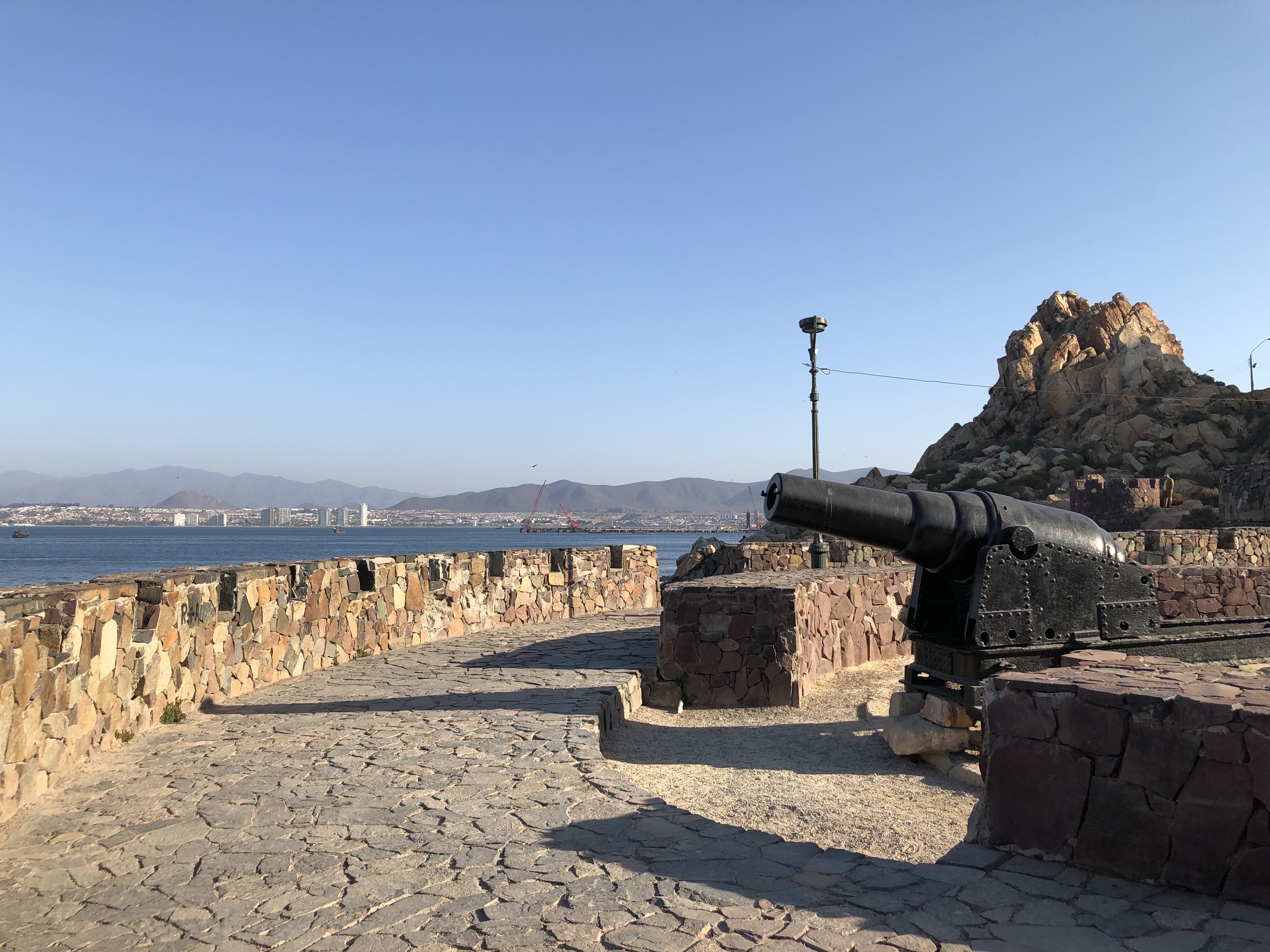
    Soldiers of the Brigada Cívica de Artillería, commanded by Eleazar Lazaeta Roldán, installed a 150-pound muzzle-loading Armstrong cannon at the centre of the fortification. The original works were built by Delmiro Koch.

  5. 1879–1883

    The battery during the war

    The fort formed part of the port’s defensive system throughout the conflict. Its value was largely deterrent: an armed bay was a bay enemy ships preferred to avoid.

  6. 20th century

    A century standing

    For more than a hundred years the structure remained standing, with the cannon at the centre of the enclosure. Without systematic maintenance, the walls and their surroundings gradually decayed.

  7. 2003

    The municipal rescue plan

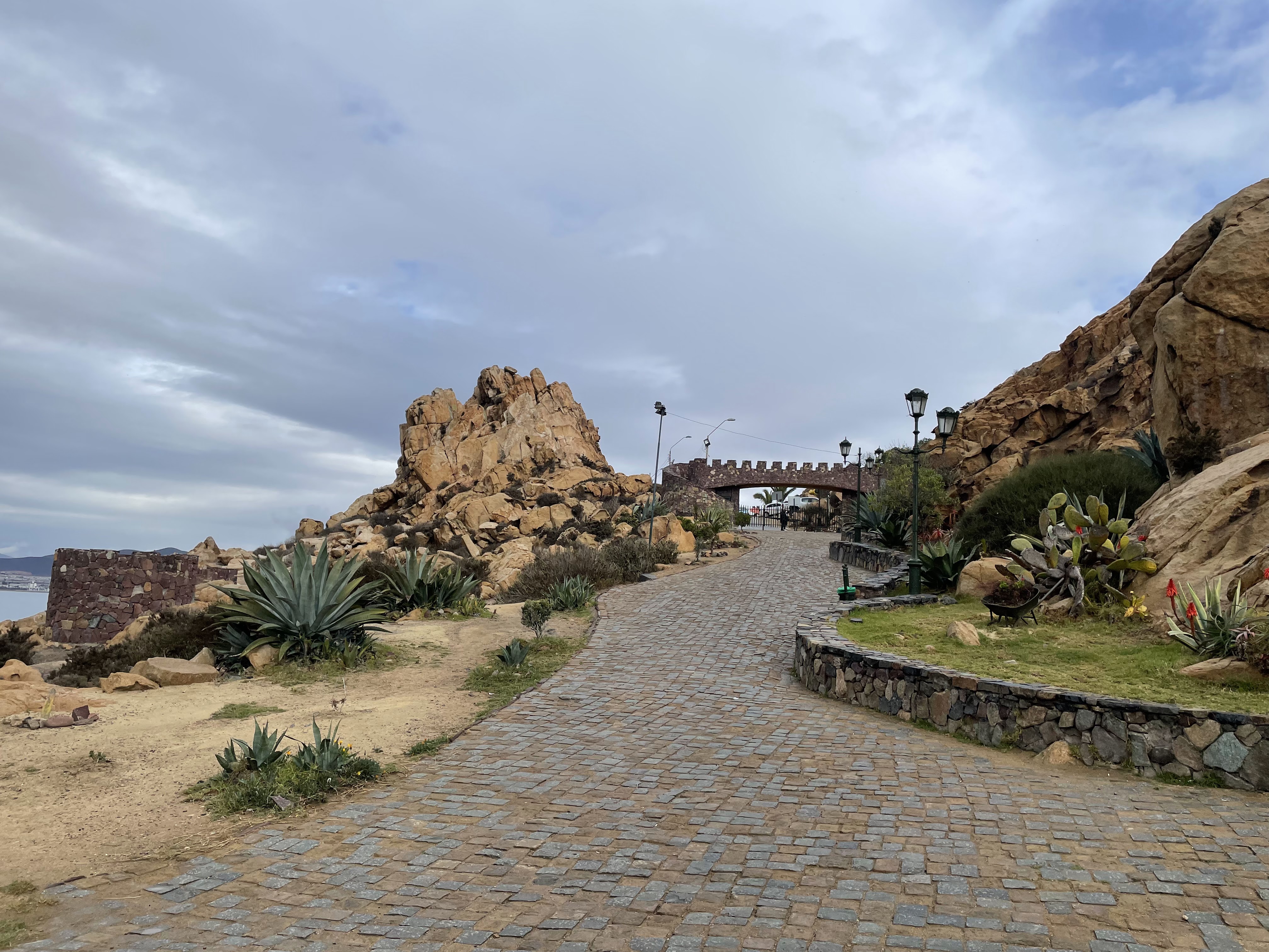
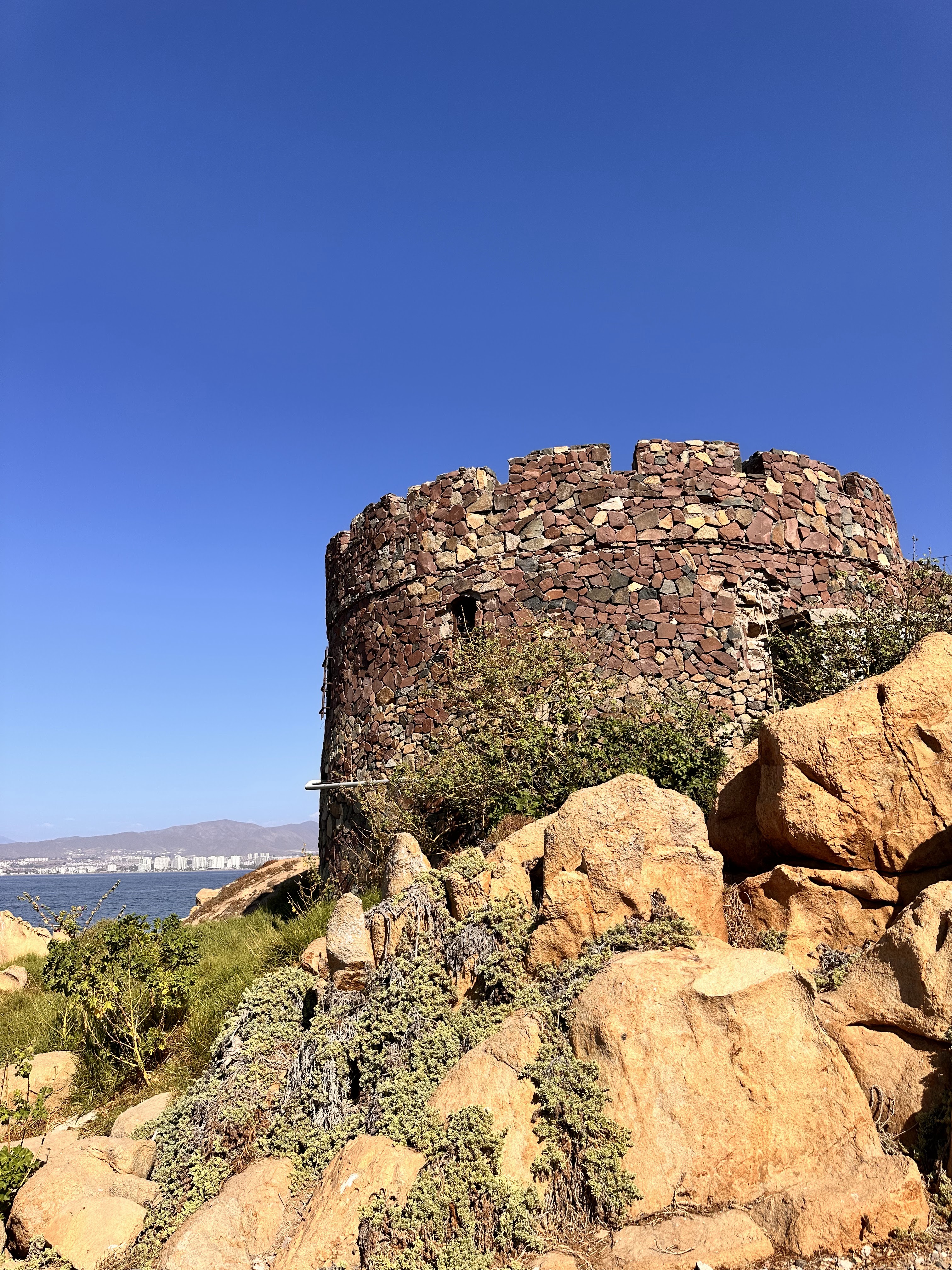
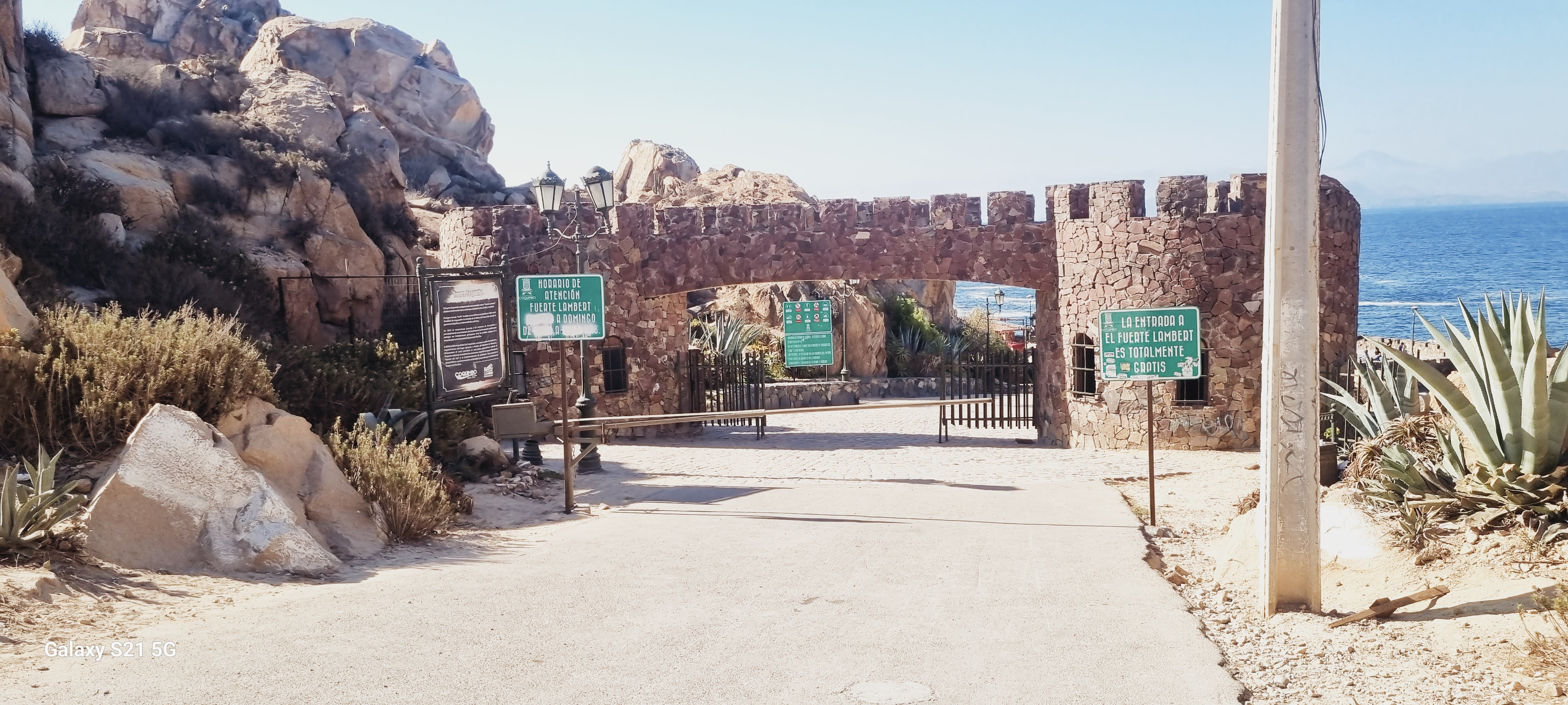
    The Municipality of Coquimbo began a rescue plan with an investment of 68 million pesos: the fortification was restored, the grounds enlarged and three stone towers were added that now serve as viewpoints, along with lamps, seating, an entrance portal built from local rock and a paved access road.

  8. 2005

    Opened to the public

    The restoration was officially inaugurated and the fort became established as one of the city’s emblematic viewpoints, open to residents and visitors.

  9. Today

    A viewpoint with a memory

    The fort is a free public space and a meeting point for understanding Coquimbo’s relationship with the sea, its port and its mining past.

What to look for inside

  • The esplanade and the gun position

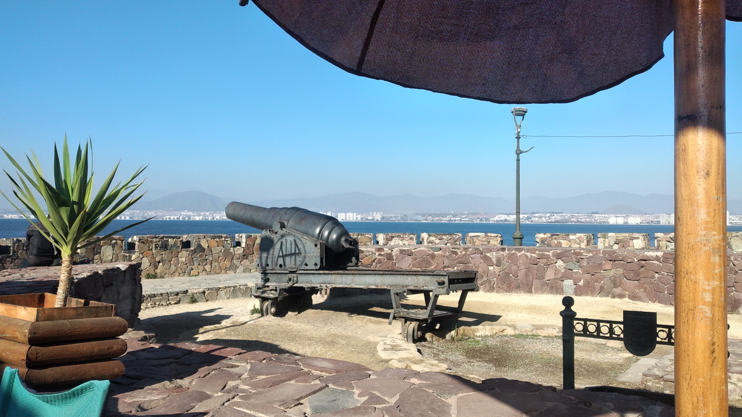
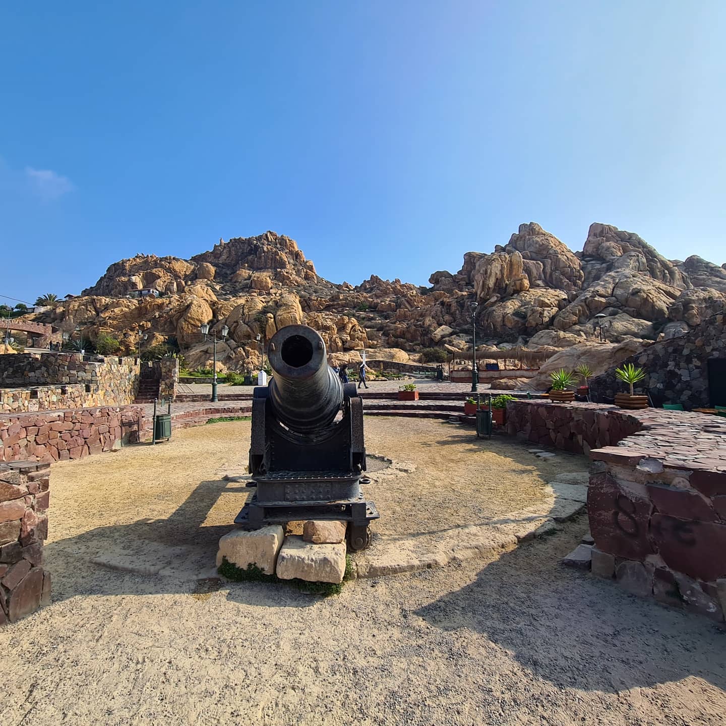
    The cannon occupies the centre of the fortification. Its siting explains the logic of the place: commanding the mouth of the bay with a single long-range piece.

  • The muzzle-loading Armstrong cannon

    A 150-pound piece loaded through the muzzle and installed in 1879. It gives the site its historical meaning and is its best-preserved element.

  • The three stone towers

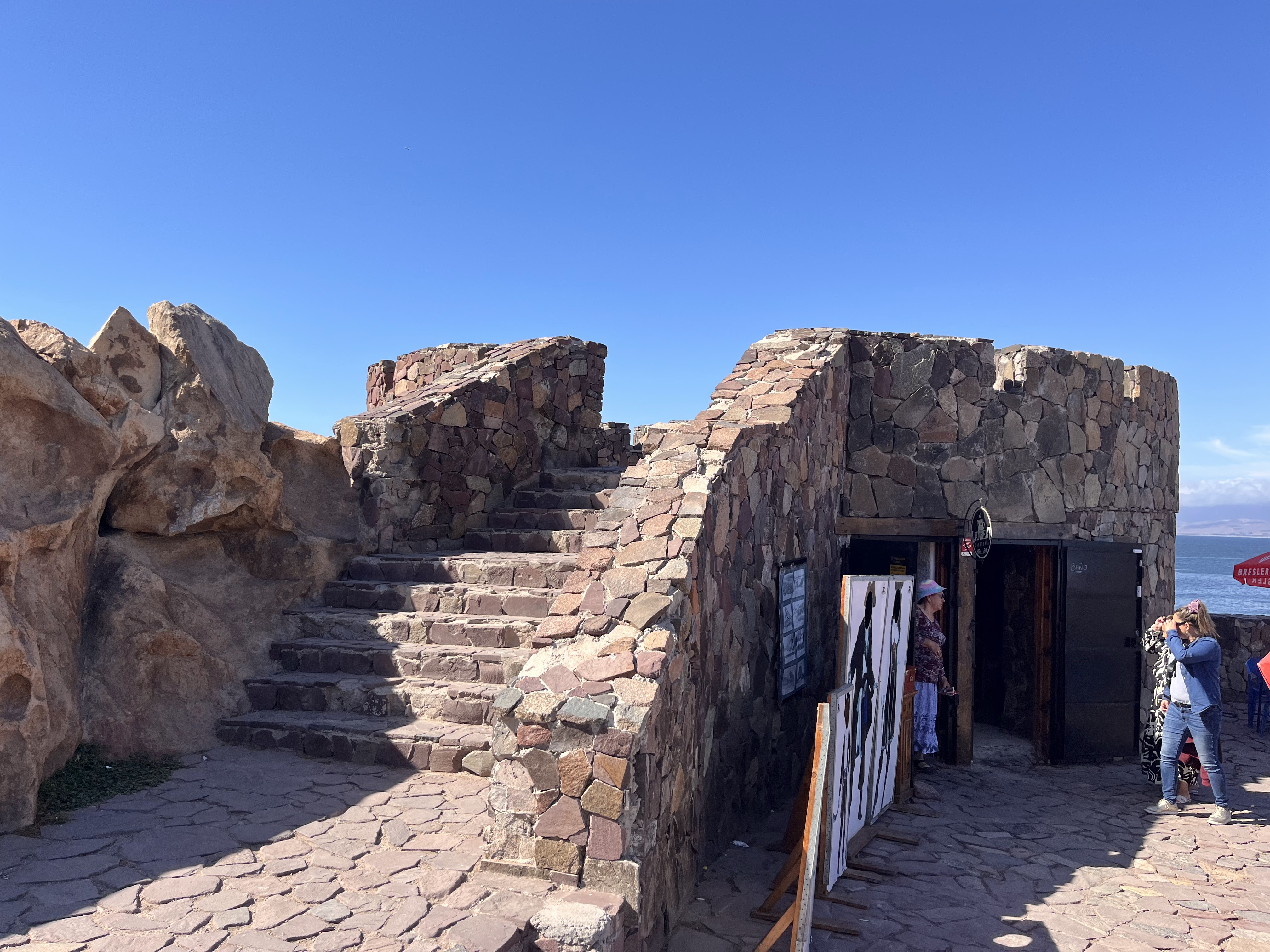
    Added during the 2003–2005 restoration, they now work as viewpoints and resting points around the perimeter.

  • The entrance portal

    Two towers built from local rock frame the access; the same project paved the road up to the fort.

  • Walls and buttresses

    Notice how the wall follows the slope of the hill: the topography itself was part of the defence and dictated the firing angles.

  • The viewpoint edge

    Walk the perimeter to reconstruct the line of fire and the sightlines the battery controlled. Some edges have no railing: keep your distance.

Reading the landscape from the top

  • To the north, the bay of Coquimbo and the port area of Guayacán, the economic heart of the city.
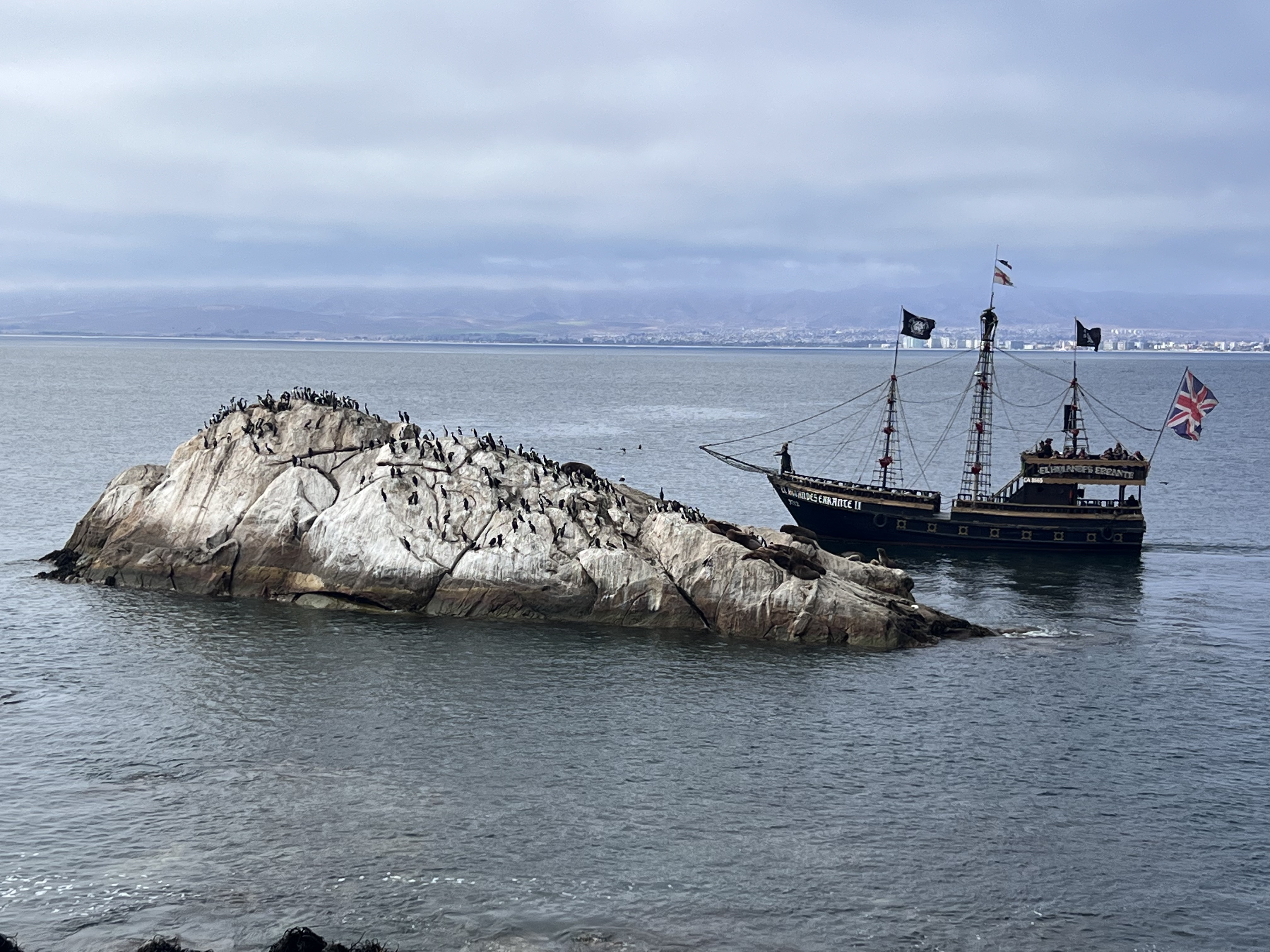
  • Directly ahead, the Punta Pelícanos islet, which gave the sector its name and where seabirds rest.
  • The Cruz del Tercer Milenio on the neighbouring hill is the most recognisable landmark on the skyline.
  • Eastwards lie La Serena and, further back, the Elqui valley.
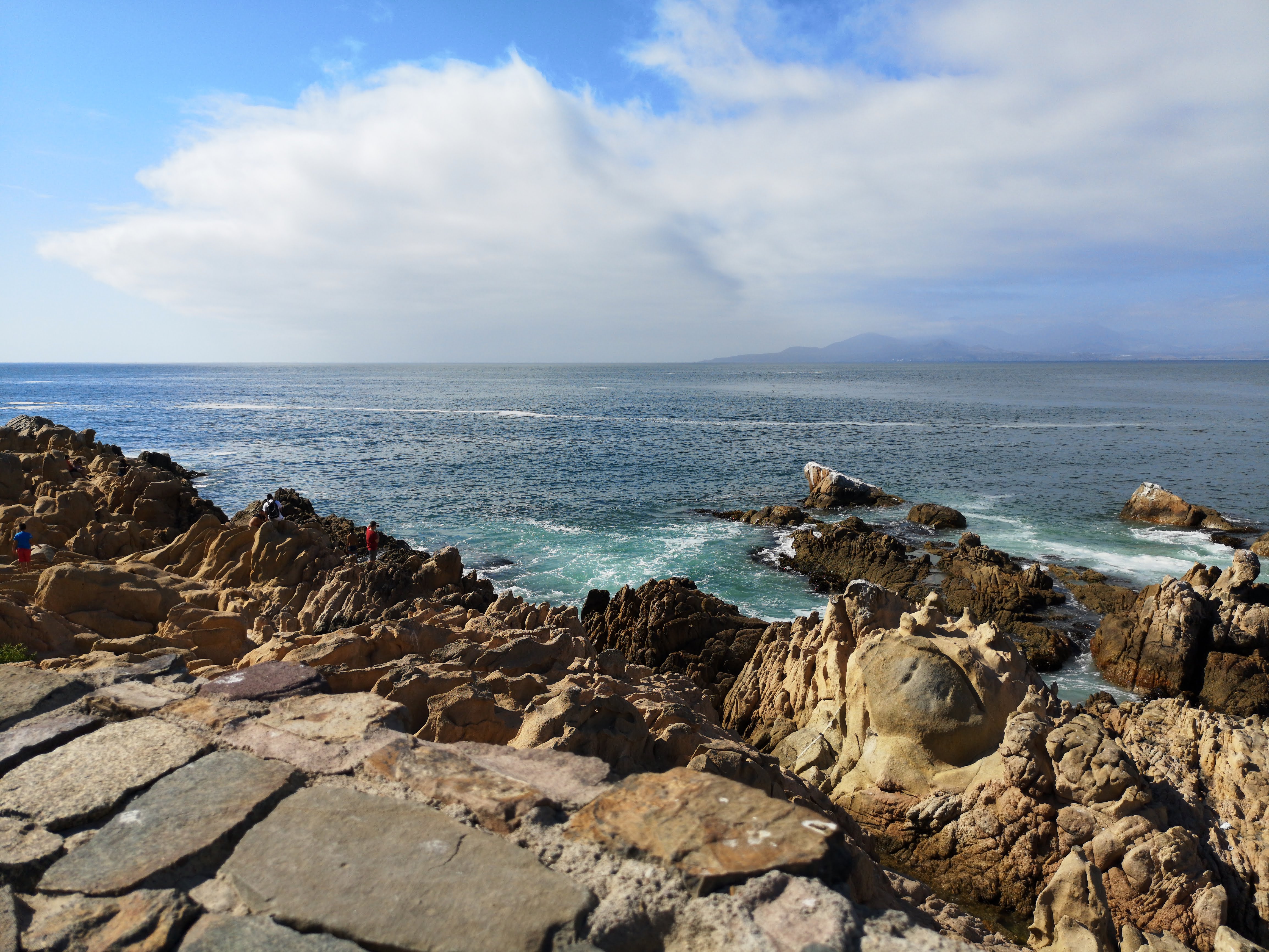
  • The open Pacific dominates the west: from here it is easy to see why this bay was so prized.
  • On clear days the Andes close the horizon to the east.

Stories and traditions of the bay

Punta Pelícanos

The sector takes its name from an islet about forty metres off the coast where pelicans gather. For anyone climbing the hill, the birds were the first sign that the port was near.

The businessman who armed a hill

Carlos J. Lambert, whose name the fort carries, was one of the region’s most influential business figures. His initiative is a reminder that in the nineteenth century defending a port could also be a private undertaking.

A city and its oral tradition

Coquimbo’s memory has been passed on mainly by word of mouth. The book «Coquimbo, tradición y leyenda» by Alfonso Villanueva Pizarro (1989) gathers much of that collective account of the port, its hills and its people.

A note on sources — The dates and details in this section come from historical sources and the local press, and are presented for general information. For academic or heritage purposes, please verify them with the Consejo de Monumentos Nacionales and the municipal archive. If you spot an error, write to us and we will correct it.

Selected Impressions

Two short visitor quotes break up the long read and reinforce the fort's mix of panorama and history.

“A place full of history. You understand why they put it on top of the hill: the viewpoint is 360 degrees. Great to go with family.”

Diego M., February 2026

“Sunset from the fort, with the Cruz del Tercer Milenio in the background, is spectacular and makes the strategic setting immediately clear.”

Tomas V., December 2025

Practical Planning

Visitor Guide

A morning or late-afternoon visit usually offers softer light, a more comfortable climb and the clearest sense of the bay below.

  • Allow around 40 to 70 minutes to cover the ramparts, cannons, tunnels and panoramic esplanade.
  • The site stands at Camino Al Fuerte 20, with the final access stretch climbing uphill once you reach the hill.
  • Wind and sun exposure are stronger here than in the town centre, so bring water, sun protection and a hat.
  • If travelling with children or older companions, a taxi or colectivo is the easiest way to handle the last stretch.

Visitor Reviews

Visitor feedback is available on Google Maps (external link).

C
Camila R.
March 2026

Incredible view of the whole bay. We went early and there was almost no one there; the cannons and tunnels are very well preserved. A must in Coquimbo.

D
Diego M.
February 2026

A place full of history. You understand why they put it on top of the hill: the viewpoint is 360 degrees. Great to go with family.

F
Francisca L.
January 2026

A very good outing if you are around La Serena. The drive up is comfortable and the esplanade is well worth it. Bring water, it's windy up top.

T
Tomás V.
December 2025

Sunset from the fort, with the Cruz del Tercer Milenio in the background, is spectacular. Perfect for photos and to learn the military history of the area.

How to Get Here

Camino Al Fuerte 20, Coquimbo, Coquimbo Region, Chile

Fuerte de Coquimbo — Camino Al Fuerte 20, Coquimbo, Región de Coquimbo, Chile

Coordinates: 3M87+8H Coquimbo, Chile · -29.9341853, -71.3360829

For official updates and regional tourism information, visit the Región de Coquimbo Official Tourism Portal .

Sources & References

This independent guide is compiled and cross-checked against official and institutional sources.

Consult the official portals below for verified information about the fort, its address and its protected status.

Fuerte de Coquimbo — Camino Al Fuerte 20, Coquimbo, Región de Coquimbo, Chile

Frequently Asked Questions

Practical information on facilities, history and planning your visit to Fuerte de Coquimbo.

Parking
On-site and nearby areas
Restrooms
On-site and in Coquimbo centre
Fuel / EV
Fuel and EV charging in Coquimbo and La Serena
Accessibility
Ramps on esplanade; some stair sections

Transport & Facilities

Is there parking nearby? How much does it cost?

Yes. The fort grounds have on-site parking and there is additional space around the hill. Parking is usually free or low-cost; in summer (January–February) it fills quickly, so the best option is to arrive early or use public transport or a taxi.

Can wheelchairs or strollers get close?

The main esplanade and reception area have ramps and are accessible, but the site is on a hill and some ramparts and tunnels have steps or uneven floors. Ask at the entrance about the accessible route for wheelchairs or strollers.

Are there restrooms or food nearby?

The site has basic restroom facilities. To eat or drink, downtown Coquimbo and the port are a few minutes away, with cafés, restaurants and seafood spots a short drive or colectivo ride away.

History & Trivia

Why was the fort built on the hill?

The fort was placed on top of the hill that closes the bay because that position dominated maritime access and allowed the port of Coquimbo to be watched over and protected. The height made it an ideal military watchtower and, today, a 360-degree panoramic viewpoint.

What can you see inside the fort?

The visit includes ramparts, historic cannons, tunnels and the upper esplanade, from where you take in the peninsula, the harbour and the Cruz del Tercer Milenio. It is a 19th-century military site and one of the most beloved viewpoints of the Coquimbo Region.

Planning & Tickets

Is there an entrance fee?

The site is usually free to enter; if there is a temporary management change, special event or schedule adjustment, confirm it at the entrance. The esplanade and viewpoints are visited within opening hours (10:00–20:00).

How long does a visit take?

A typical visit lasts 40 to 70 minutes: climb the hill, walk the ramparts and tunnels, read the historical signage and enjoy the viewpoint. Add a stroll through the port or the Cruz del Tercer Milenio and it easily fills a morning or afternoon.

Can I go in bad weather?

The fort is open-air and can be visited in any weather, but the esplanade and slope are exposed to wind and sun. On very windy or rainy days take care near the edges; in summer go early to avoid the heat on the climb.

What to see nearby

After visiting, what else do you recommend nearby?

Very close by are the Cruz del Tercer Milenio, the port and the Coquimbo peninsula. A few kilometres away are La Serena (its Neoclassical old town and the Monumental Lighthouse), the Elqui Valley, the beaches of Tongoy and Guanaqueros, and the Humboldt Penguin Reserve on Isla Damas.